
Designing a multi-platform travel logistics experience for skiers and snowboarders.
Project OverviewThis project aimed to create a unified travel logistics experience leveraging UX design principles across multiple platforms. I chose to focus on the skiing and snowboarding experience and my solution, Slopeside, is an integrated system for ski area navigation, empowering users to navigate the resort with confidence and ease.
My ResponsibilitiesUser research, concept development, and interface design and prototyping.
Why Skiing and Snowboarding?Skiing and snowboarding have become increasingly popular recreational activities, with over 60 million people visiting nearly 440 resorts nationwide during the 2023/24 season (National Ski Areas Association). In response to growing demand, resorts have invested heavily in upgrades such as terrain expansion, faster chairlifts, and mobile ticket scanning (The Washington Post). Despite these advancements, patrons still lack tools to make informed decisions before arrival and during their visit to optimize their experience. This gap is compounded by ski areas’ reliance on static maps, disjointed resources, and limited real-time tracking features, which create significant uncertainty in the navigation process.
Solution
To address this challenge, I identified the potential of basic resort app functionality such as chairlift wait time tracking and updated lift/trail info, expanding it to provide visitors with an integrated, responsive, and personalized platform for both route planning and real-time resort navigation.My solution, Slopeside, is a user-centered resort navigation platform that leverages predictive analytics and real-time tracking to deliver tailored recommendations and streamline the planning process, ensuring you make the most of your time on the mountain.
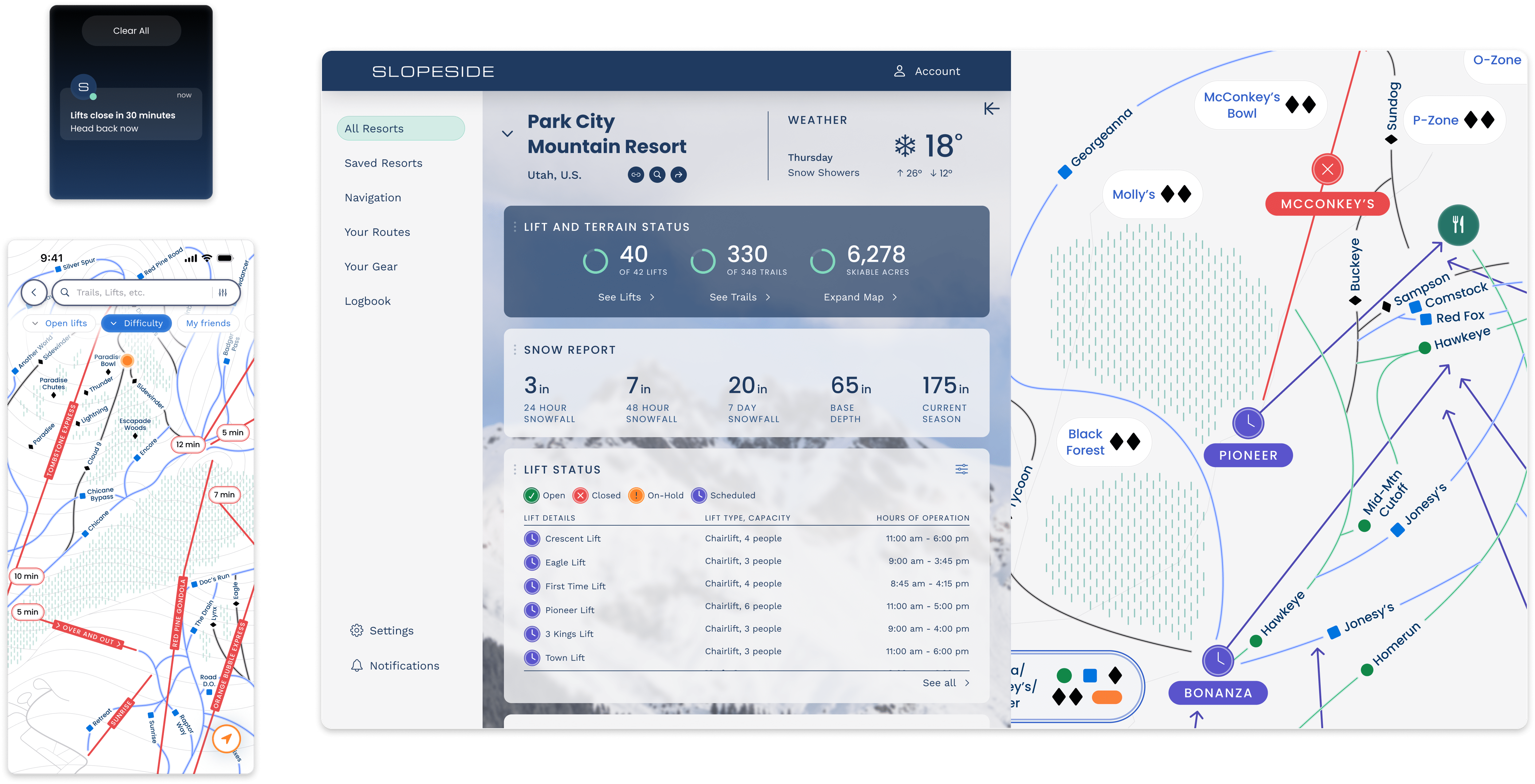
Desktop
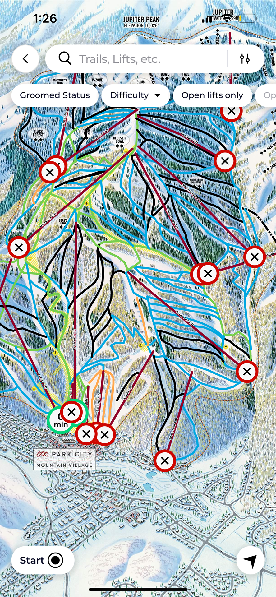
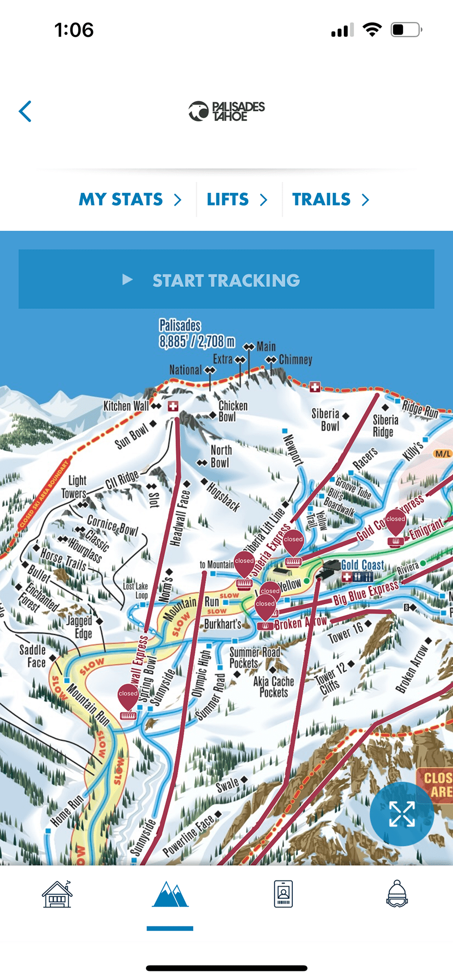
Conditions and Trail Information
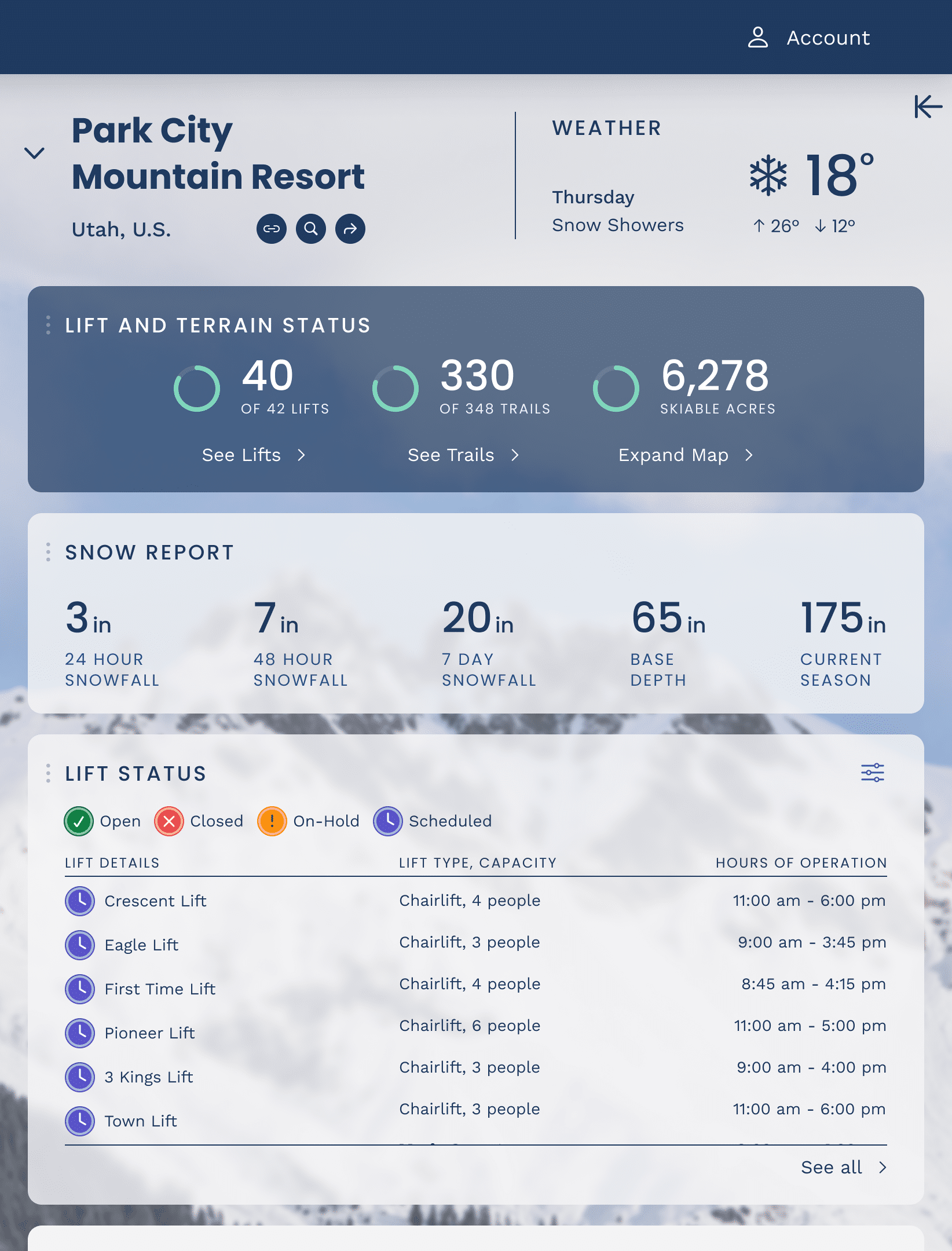 Up-to-date resort conditions and trail information. The interactive trail map helps users understand the mountain layout and plan ahead for their visit.
 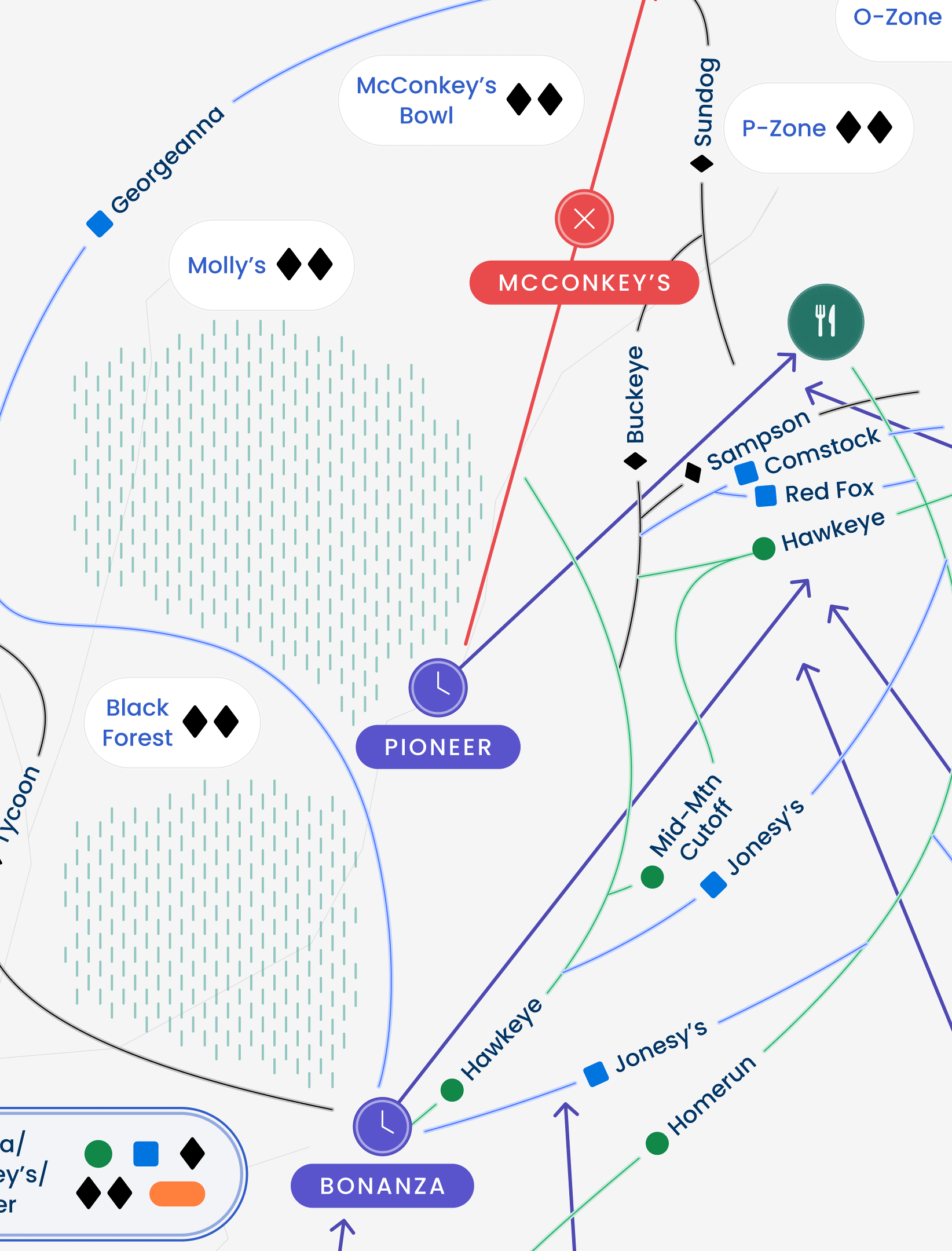 User can select trails or lifts from the information panel to zoom in to expand mountain regions for more detailed trail information.
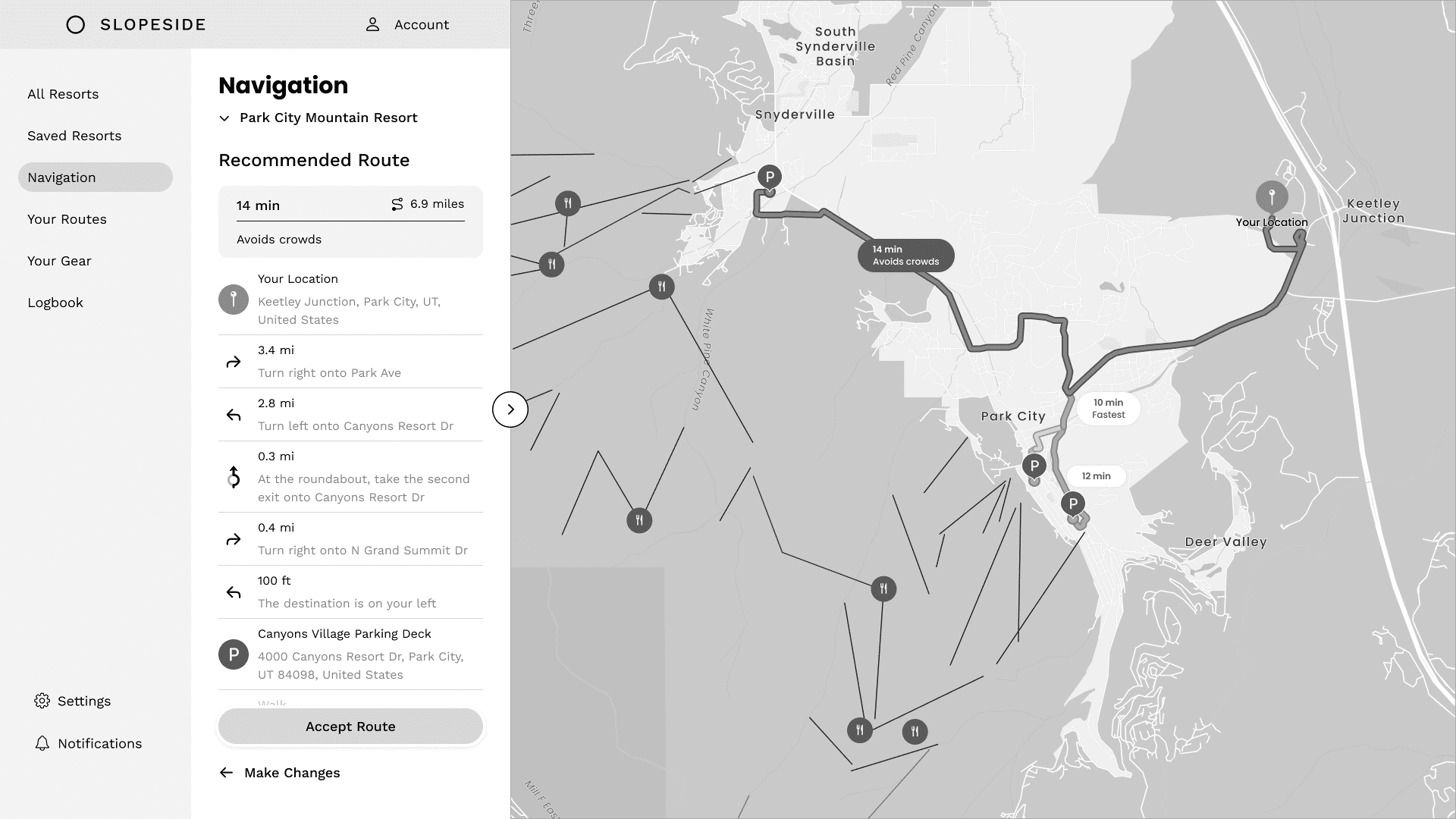
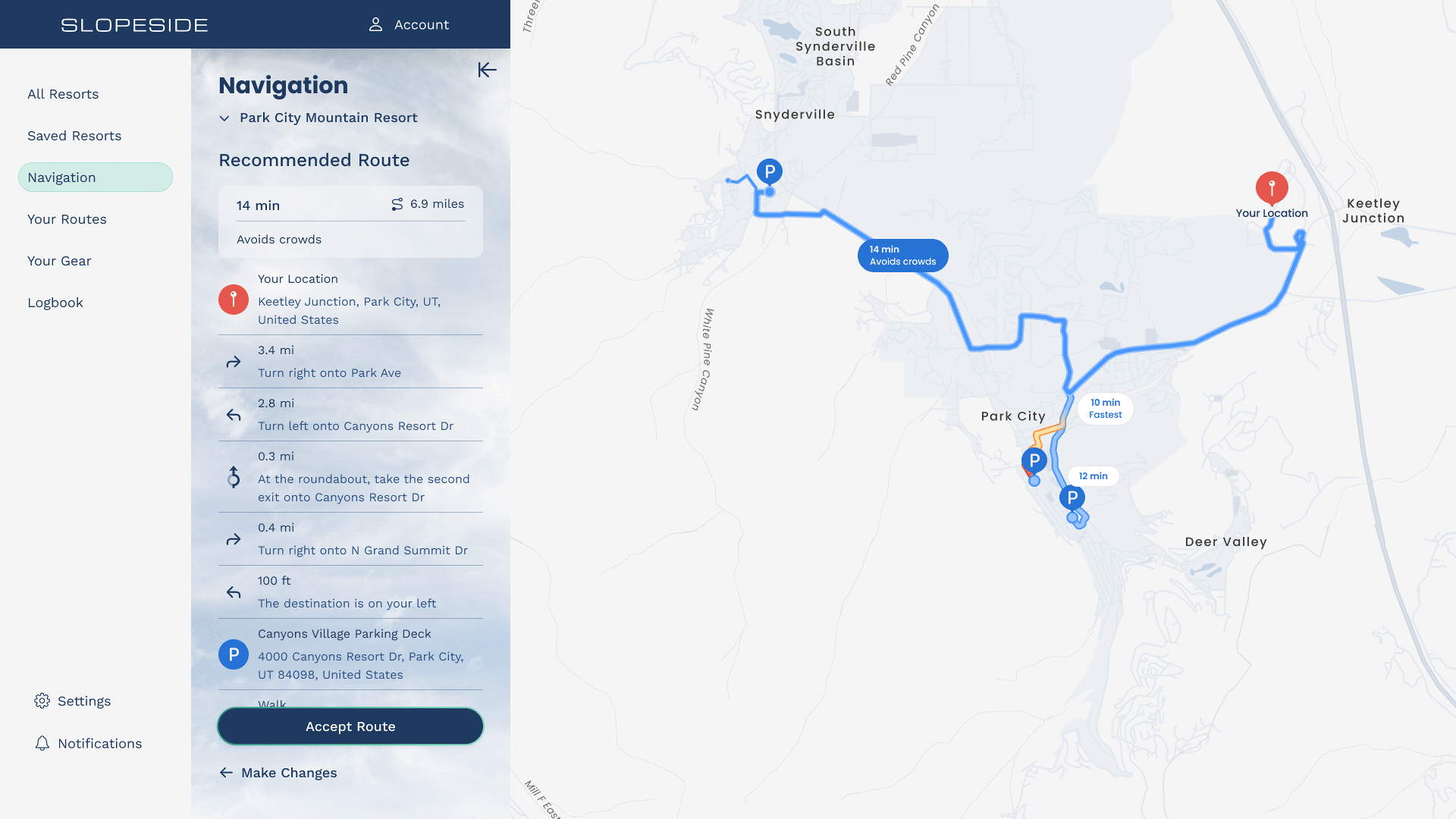
Route Planning and Navigation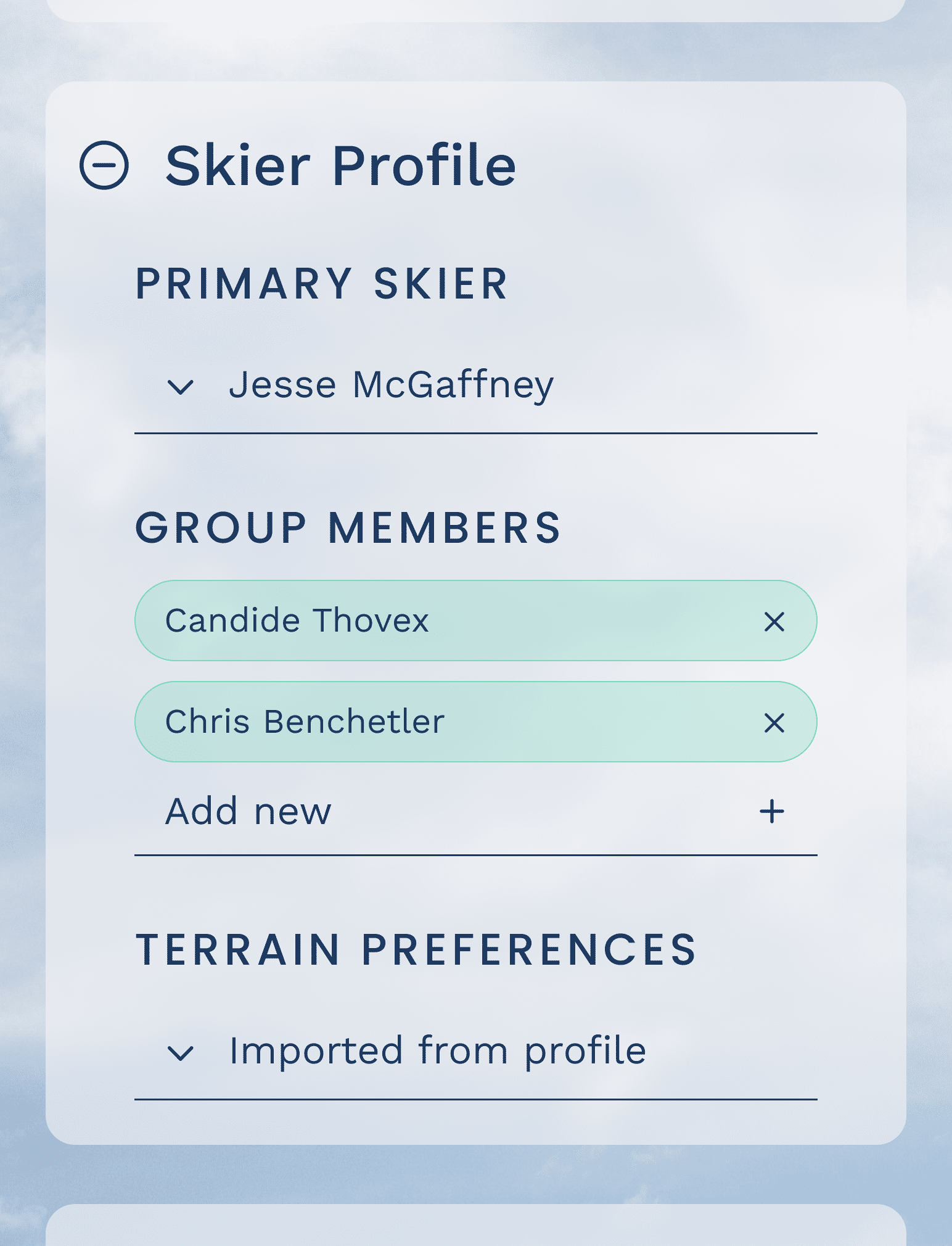 Features an auto-filled skier profile and transportation preferences to customize route recommendations.
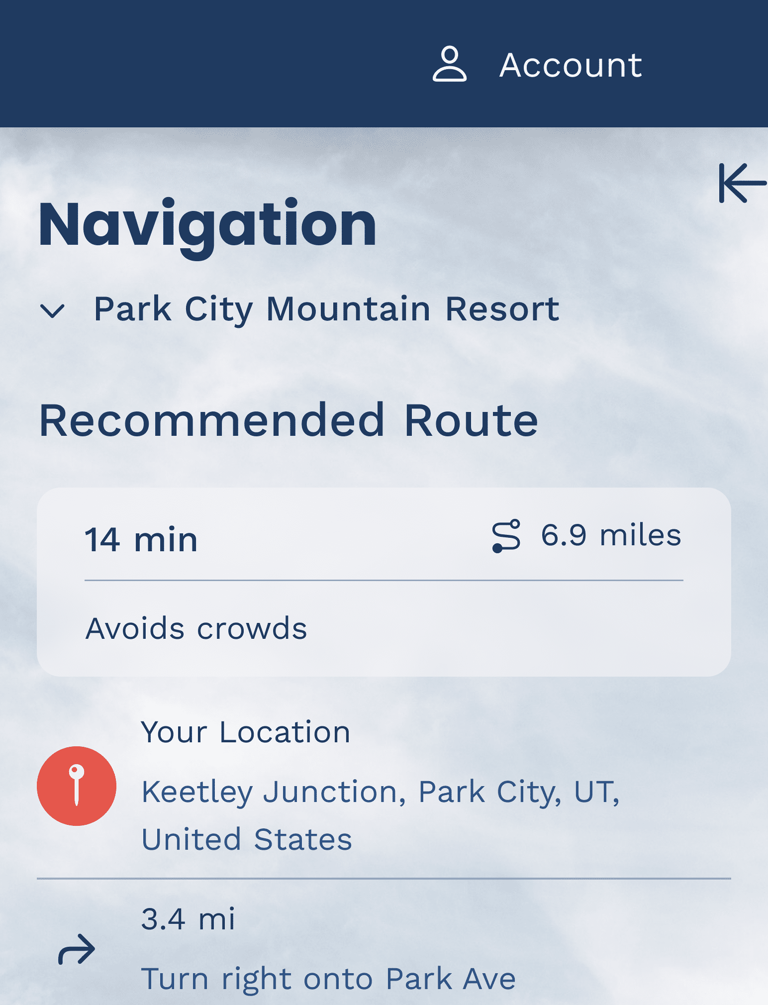 Recommended routes are prioritized based on driving preferences (avoid crowds).
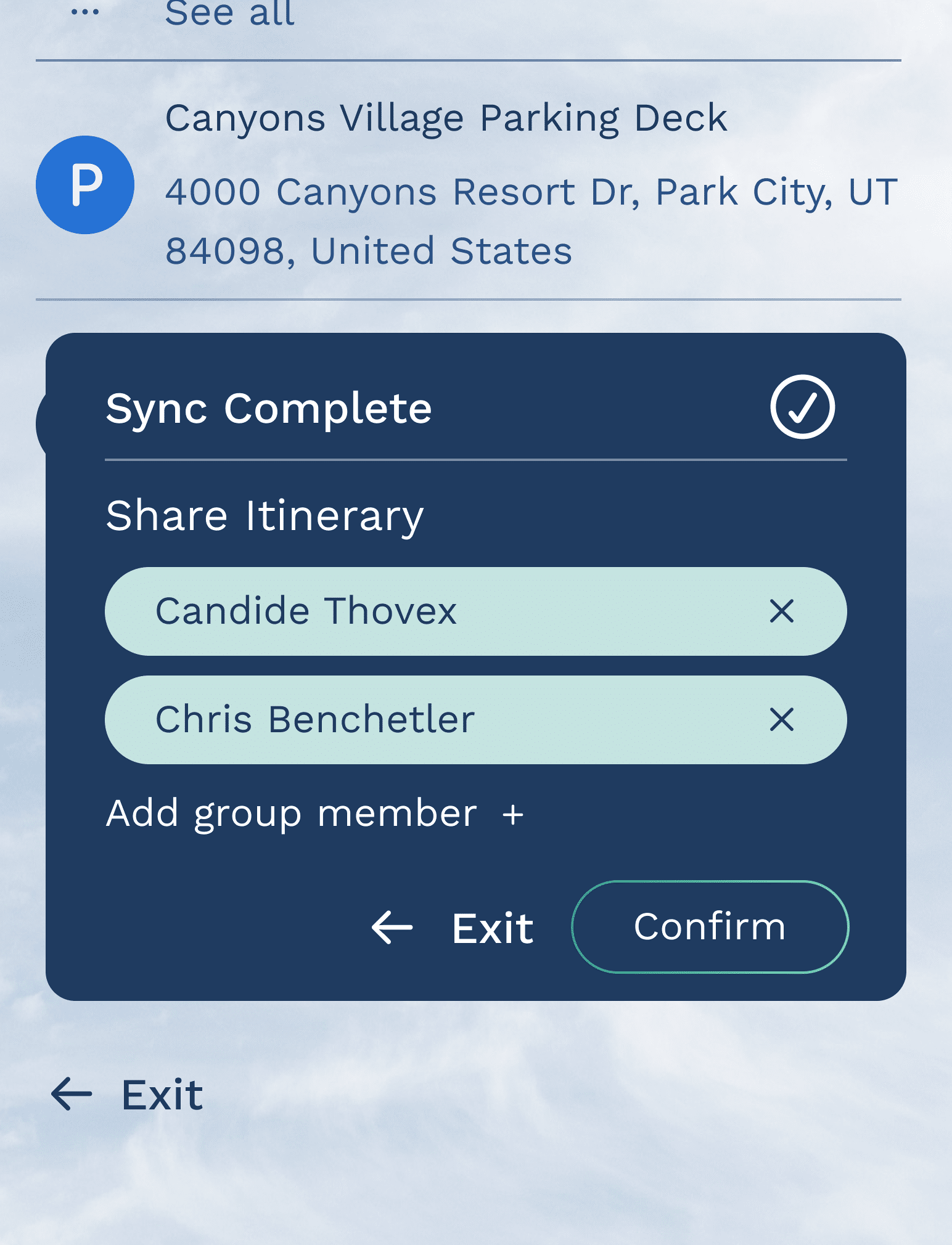 User can sync their itinerary to smartwatch or mobile and share it with their group members.
Features an auto-filled skier profile and transportation preferences to customize route recommendations.Recommended routes are prioritized based on driving preferences (avoid crowds).User can sync their itinerary to smartwatch or mobile and share it with their group members.Mobile
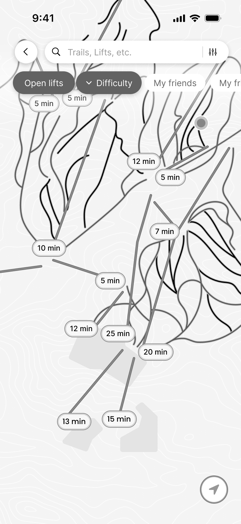
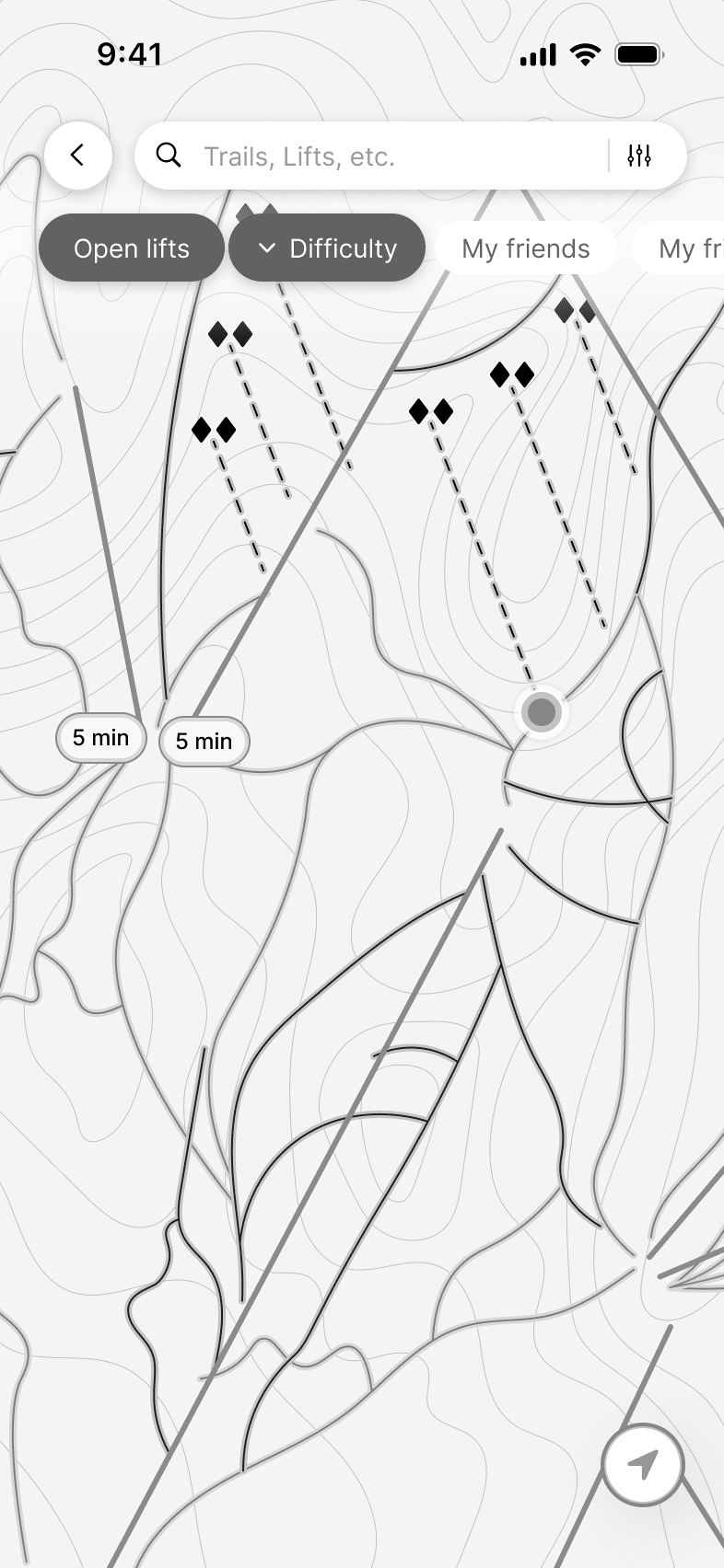
Real-time Navigation and Smart Recommendation System Clean UI provides real-time detailed trail information such as lift wait times and trail conditions without overwhelming the user with visuals.
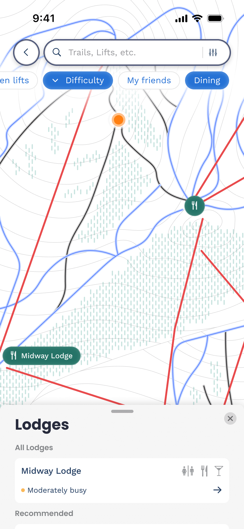 Filter for dining locations and view recommended lodges based on crowd density and proximity.
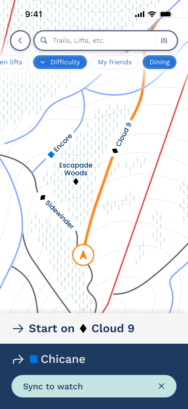 Recommended routes are provided for ease of navigation. Optional turn-by-turn navigation is provided to sync to smartwatch.
Clean UI provides real-time detailed trail information such as lift wait times and trail conditions without overwhelming the user with visuals.Filter for dining locations and view recommended lodges based on crowd density and proximity.Recommended routes are provided for ease of navigation. Optional turn-by-turn navigation is provided to sync to smartwatch. Smartwatch
Notifications and Alerts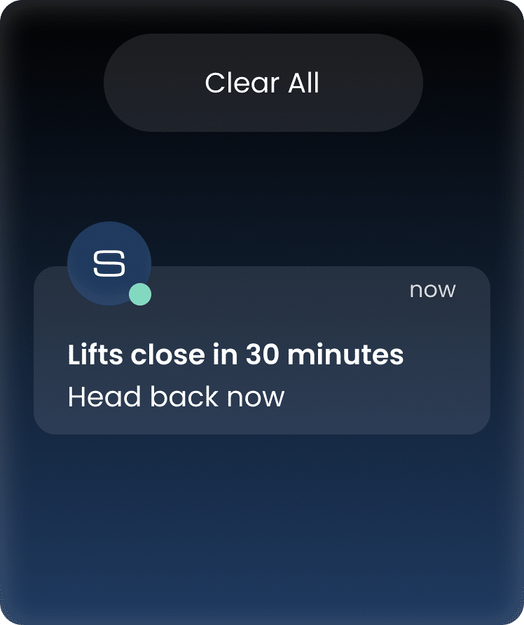 Notifications provide timely alerts of lift closures.
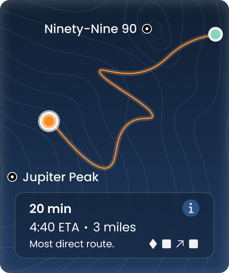 System provides route recommendations with time-to-destination and trail ratings.
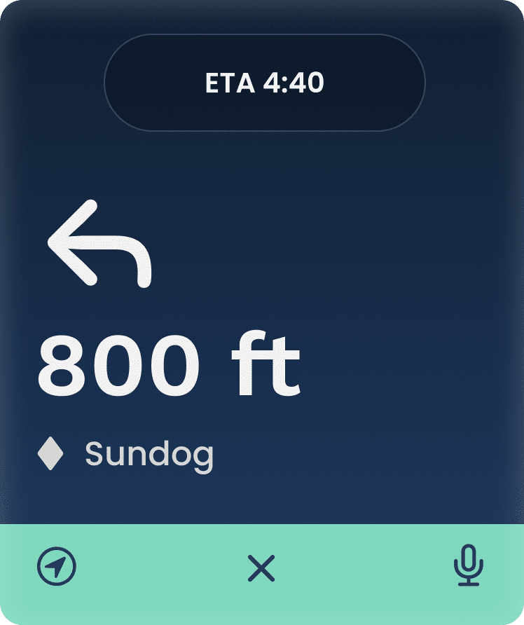 Haptic feedback provides hands-free turn-by-turn navigation.
Notifications provide timely alerts of lift closures.System provides route recommendations with time-to-destination and trail ratings.Haptic feedback provides hands-free turn-by-turn navigation.ProcessMarket ResearchI began by conducting a competitive analysis to assess the strengths and weaknesses of existing platforms.
 Epic Pass
Interactive trail maps, real-time tracking, wait times, and personalized statistics.
Map is hidden in the navigation and is visually complex. No watch integration.
 Ikon Pass
Connect with friends and compare stats. Playful UI, activity recommendations
No permanent option to save friends, map is visually complex. No watch integration.
 Slopes
Detailed activity tracking. Collaborate with and track friends on the mountain.
Too many options. No ability to customize widgets and prioritize certain features.
User ResearchInterview InsightsI interviewed several skiers who frequently plan annual trips to U.S. resorts, uncovering common pain points, opportunities, desires, and motivators.
Pain Points
Fragmented planning tools: Existing tools are decentralized, requiring comparison across multiple platforms.Uncertainty in navigation: Challenges in navigating unfamiliar resorts, including unclear trail maps and unexpected crowds. Logistical complexity: Difficulty coordinating large groups and transportation logistics.
Opportunities
Integrated experience: Supporting end-to-end trip planning tailored to user needs.Real-time updates: Dynamic features such as lift wait times and crowd tracking to support on-mountain decision-making. Group coordination: Tools for sharing itinerary and staying connected with group members.
Desires and Motivators
Streamlined trip planning: Users value simplicity and consolidated resources.Memorable experiences: Emphasis on creating shared memories and maximizing their time on the mountain.Post-activity insights: Interest in reflecting on data such as trail heat maps and overlays to inform future trips.
Empathy MappingI developed an empathy map based on interview insights to deepen my understanding of my target users and lay the foundation for creating a user persona.
Persona: Jesse the Expert Skier
Jesse is an expert skier and has been skiing their whole life. Every year they plan a big ski trip to extend their season and participate in one of their favorite leisure activities.Jesse has a season pass to a network of resorts and enjoys the challenge of skiing difficult terrain. They prefer large resorts so they can take advantage of their infrastructure and have a variety of experiences during their trip.
Goals and Needs
- Integrated platform for real-time info on resort access and logistics.
- Straightforward and personalized logistics information.
- Real-time tracking and route planning features.
Pain Points
- Experiences uncertainty concerning conditions and navigation.
- Struggles to decide where to start and what parts of the mountain to explore.
- Frustrated by unexpected traffic and wait times.
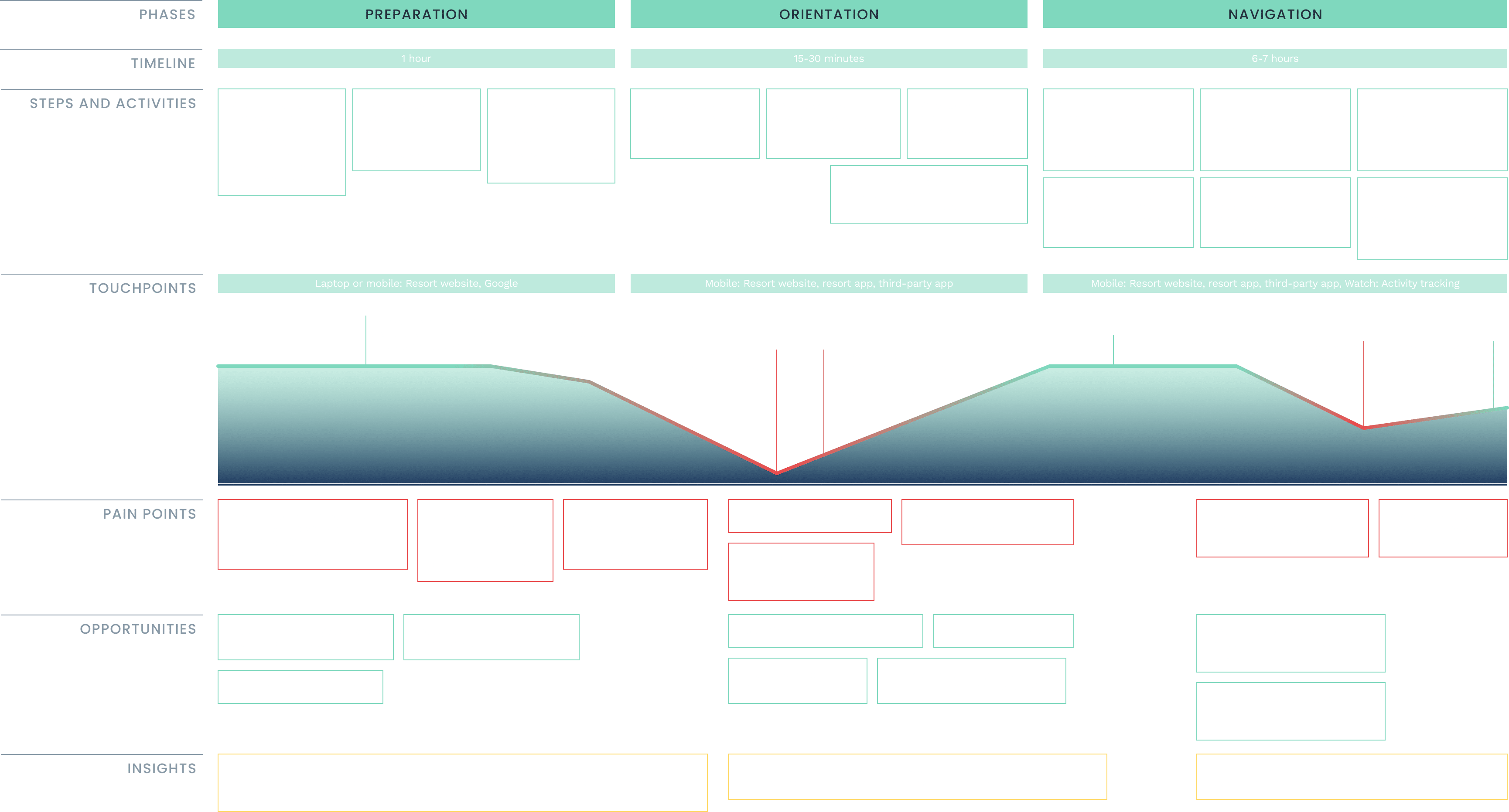
User Journey Mapping
The user interviews helped break down the current user journey into three main phases — preparation, orientation, and navigation.I determined that an effective approach would be to create an integrated navigation experience across platforms, leveraging real-time tracking and personalized recommendations to streamline the user journey.
User StoryJesse, an expert skier, wants access to personalized and real-time information about resort access and conditions to achieve the goal of navigating the resort with ease.The current inability to do so is creating significant uncertainty in the navigation process. Enabling them to do this would reduce stress and frustration, improving their overall experience of the resort.
User FlowI developed a user flow to clearly define the pathways users would follow on each platform to complete distinct tasks. This process also helped me understand how the platforms integrate, generate feature ideas, and identify key screens for development.

Concept DevelopmentLow-Fidelity WireframesMy sketches allowed me to visualize specific features and identify key interactions.
CSS Lightbox Gallery


Mid-Fidelity WireframesEarly in my process I recognized the importance of a map. Through rapid iteration and user feedback, I refined the map design for both desktop and mobile, optimizing it for specific use cases. 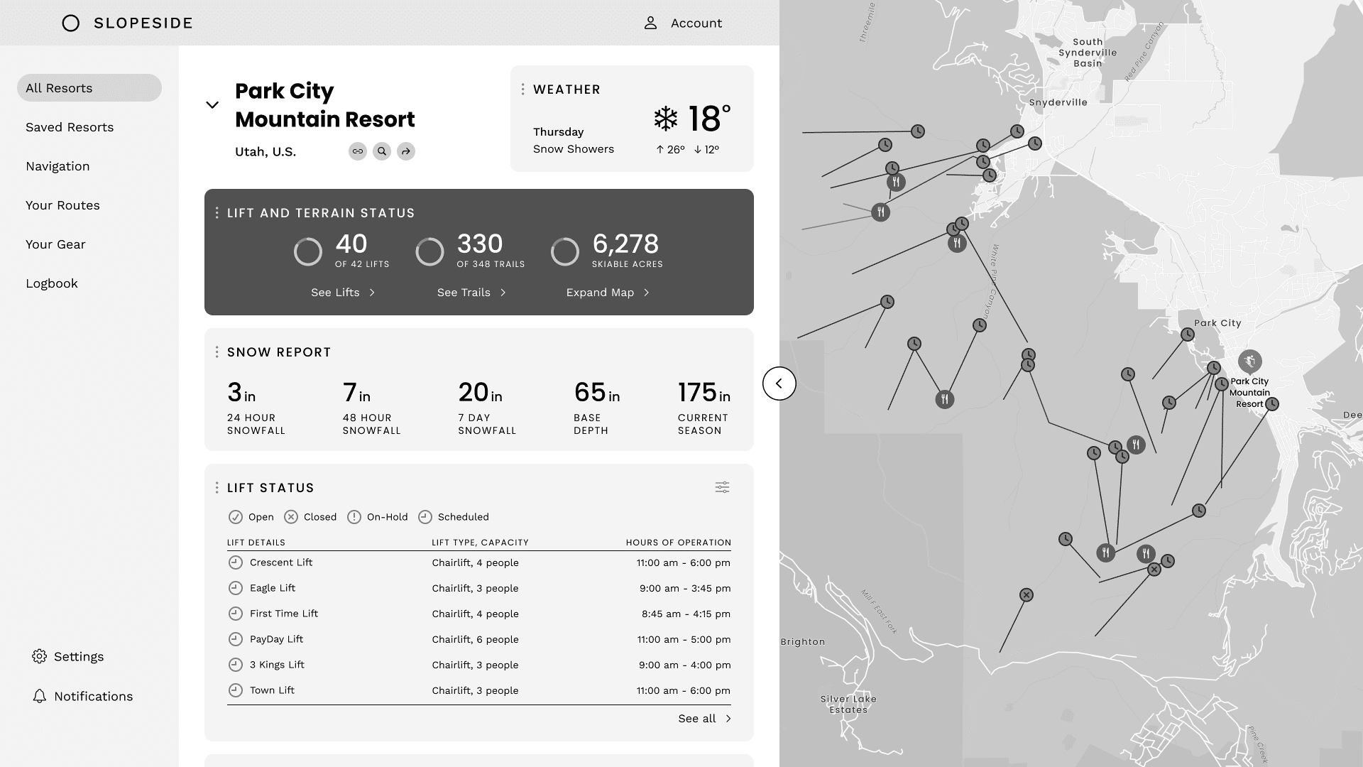
User TestingI conducted a feedback session with one of my interviewees and prioritized refining the mobile platform trail map to due its visual complexity.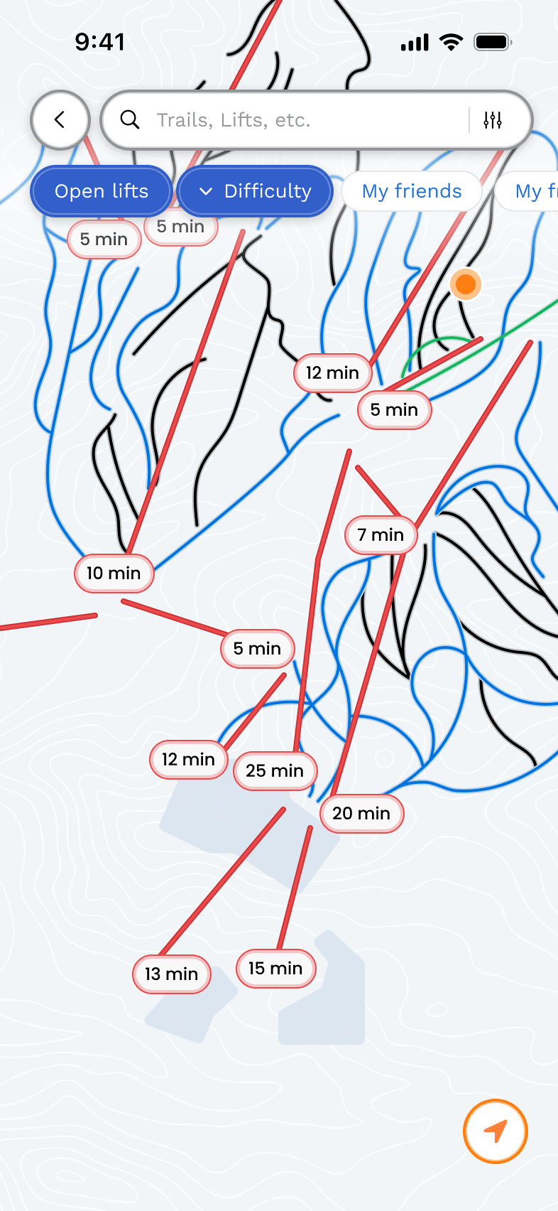 First iteration
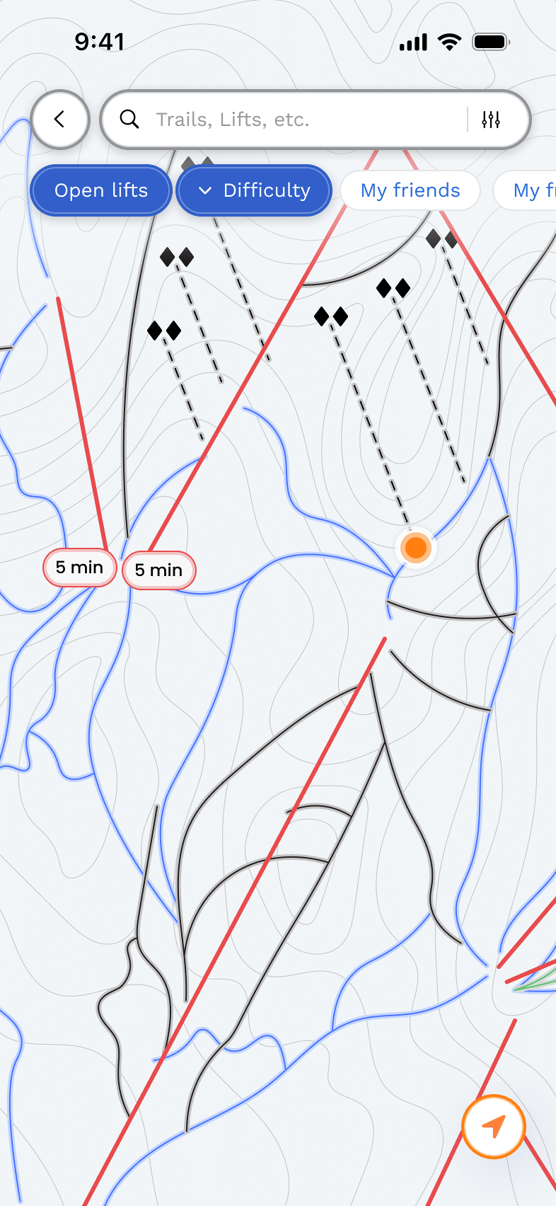 Second iteration
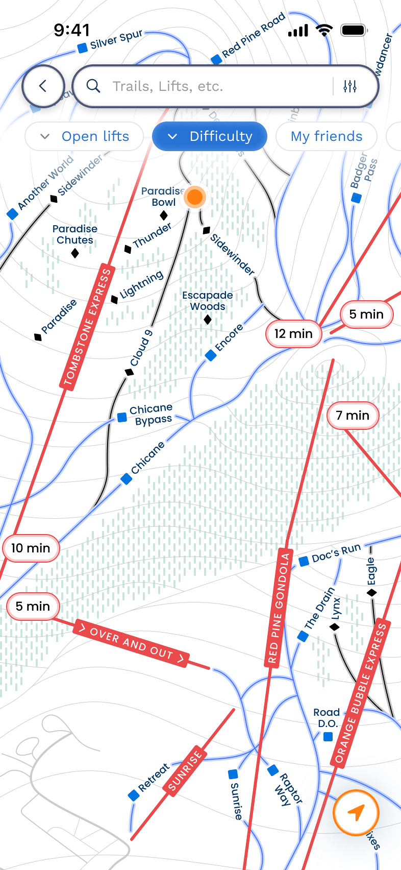 Final iteration
Key Insights
- Topographic lines did not help the user orient themselves to the landscape (sense of depth).
- Desire to see trail symbols and names, lift names.
- Desire to see a distinction between trail types (groomed, chutes, glades).
- Trail lines felt too crowded and overwhelming.
Final IterationThe final iteration incorporates user feedback and distinguishes trails and mountain regions, providing a high level of detail while maintaining a clean UI.
First iterationSecond iterationFinal iterationHi-Fidelity PrototypesThe final prototypes demonstrate an integrated, multi-platform travel logistics experience. Each platform serves a unique purpose, ultimately addressing navigational challenges and helping skiers maximize their time on the mountain. 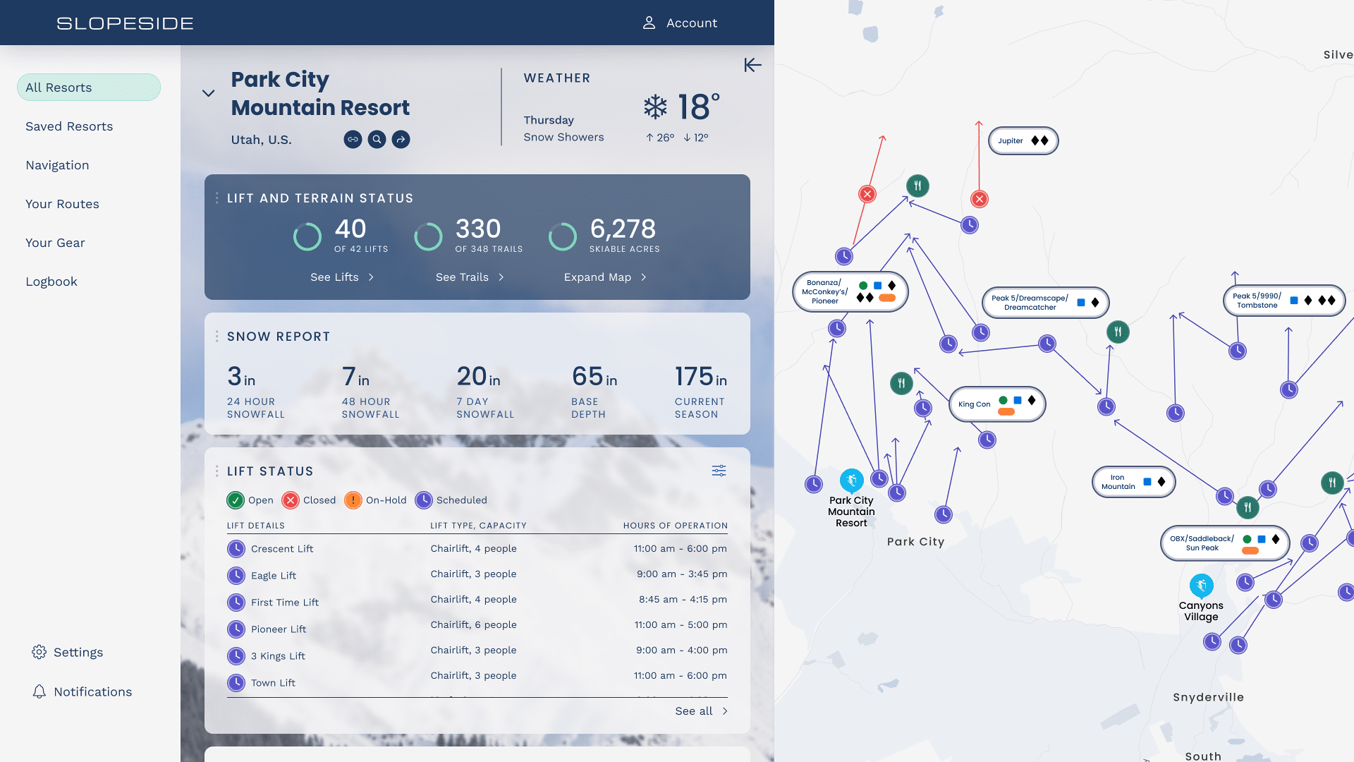
Desktop
- Consolidated resort and mountain info.
- Interactive map with mountain regions and trail/lift statuses.
- Autofilled skier profile for personalized route recommendations.
- Option to sync to watch and mobile and share itinerary with group members.
Interactive Prototype
Mobile
- Clean UI with detailed trail information.
- Recommended lodges based on crowd density and proximity.
- Recommended routes are highlighted in a distinct color for ease of navigation.
Interactive Prototype
SMartwatch
- Real-time notifications and alerts.
- Route recommendations with time-to-destination and trail ratings.
- Haptic turn-by-turn navigation.
Interactive Prototype
Reflection and Next Steps
It was a unique challenge to consider the integration of systems into one consolidated platform. Next steps for this project would include more rigorous user testing across all three devices and further refinement of features and pathways, ensuring alignment with both user and business goals.
Future WorkIf I were to continue working on this project, there are a few features I would include to increase value:
- Detailed parking information such as reservation requirements and pricing.
- Recommended departure times based on crowd trends.
- On-mountain group coordination.